Kang Rinpoche the Precious Mountain, more commonly known as Mount Kailash is in far Western Tibet near the borders of Nepal and India. The mountain rises from the Tibetan Plateau to 6,638m above sea level and is millions of years older than the Himalayan range which lie just a couple of hundred kilometres to the south. Mt Kailash may be the most holy mountain in the world, sacred to over a billion Hindu’s, Buddhist’s (predominately of the Tibetan tradition), Bonpo’s and Jainas.

The shape of the mountain is one of the reasons why this place is so special as it resembles a primordial stupa. A pilgrimage around the mountain is believed to purify a lifetime of negative Karma while 108 circumambulations will lead to Nirvana in this very life time. Some Tibetans complete the 54km circumambulation of Mount Kailash in a single day while others usually do it in 2 or 3. Over 18 days I travelled from Kathmandu to Mount Kailash and back again with a great group of 5 other travellers plus our Tibetan Guide and two Tibetan drivers.
Day 1 Kathmandu (~1,300m) to Nyalam (3,750m)
It was an early start from Kathmandu and we were on the road just after 6am. There had been a fair amount of rain the night before and as a result we had to take a detour from the main road to avoid a landslide. The detour was actually quite nice and took us through some farmland and villages. Once back on the main road we made good time making it to the border in about 4hrs including a stop for fresh hot chapattis and chickpea curry for breakfast.
 |
| Just over the border |
It took about an hour to get through the border and then another 2-3hrs on the Tibetan side to organise permits and things. Our guide who we meet at Chinese border control looked after all that while we exchanged money and had lunch. It was then about an hour drive up through a stunning gorge to Nyalam which rested at the edge of the Tibetan Plateau. The landscape changed almost instantly as we left the lush green rainforest of the gorge and entered an almost barren desert with snow-capped mountains.
Nyalam is a dirty little town with not too much going for it but at 3,750m we need to stop for a few days to acclimatise.
Day 2 Nyalam – Visit to Phukaro Cave (3,950m)
After a full day in the car the previous day and a huge jump in altitude we all had a well needed sleep-in especially considering we were kept up much of the night by the night club across the road that blasted terrible dance music until 4 or 5 in the morning. We later discovered that it was the Chinese police who partied it up here every night of the week!
 The plan for the day was just to relax, get use to the altitude and do a short hike up to Phukaro Cave. After a late breakfast we headed off out of town and up a neighbouring hill. It was a beautiful sunny day and the sky was blue as blue could be. On the way up to the cave there was a little water powered prayer wheel and a Mani wall. The cave was quite small but large enough for one or two people to camp in and a separate meditation room which was supposedly used by Milarepa. Inside there were many khata's (offering scarfs), some candles, money offerings and a Milarepa Thangka that was quite old. The view from the cave looked over Nyalam which we could now see was set at the foot of some impressive, jaggered snow-capped mountains. It was only about a 3hr return journey and was nice easy walk.
Day 3 Nyalam – Dara Lake or so was the plan… (4,350m?)
After breakfast we set off at about 9.30 in the jeeps. We drove out of town and up through a grassy valley that was littered with rocks of all sizes. The road zigzagged up a small hill and we jumped out about half way up. The girls having spoken to Roger (our tour organiser happened to be in Nyalam) the night before were sure we were going the wrong way but we continued on.
We left the road and followed a walking track up the mountain. It wasn’t too steep but given the altitude and that we had only been up this high for a couple of days the lack of oxygen in the air really took it out of us. We could see the road go around the edge of the hill but we went up and then around. After a bit of a climb we eventually ended up back on the road. We followed the road through another valley, around some marshy grasslands where the yaks were grazing and headed straight towards a glacier.

After about 2 ½ hrs we made it to a lake that was fed by the glacier. It looked a bit like a quarry but I think it was all natural and rock covered area was caused by the glacial movement. Our guide said that he thinks this is the place and we rested for about an hour. We walked all the way back to town and found a Gompa that was surrounded by prayer wheels which was a nice bonus. Everyone was pretty exhausted and after consulting the map which none of us had taken (we thought our guide would know where to go) it was confirmed that we were nowhere near the lake we were supposed to visit. Although a bit tough, largely due to the altitude, it was good hike and was good for our acclimatisation.
Day 4 Nyalam – Milarepa Cave (3,950m)

We were all still a bit tired from the previous days expedition and the disco that was going on across the so thankfully it was an easy day today and after breakfast we all piled in the jeeps and headed about 40mins out of town to Milarepa’s cave and Gompa. The road trip was pretty nice and bordered some steep valleys housing a few Tibetan settlements and farming land. The bright green crops were quite a contrast to the barren rock landscape that surrounded them.
 The cave and Gompa was just a short walk from the main road and we were mobbed by a group of kids on the way down asking for money and trying to sell us flowers that they had picked from the garden. There was just one monk who was the Gompa keeper and he gave us a tour. The cave supposedly was used by Milarepa and there are two hand prints in the stone roof where he pushed it up as it was originally too low. The story goes that Milarepa, after lifting the roof told one of his disciples to fetch a boulder as big as a yak which would then hold the roof up. He returned with the rock but it wasn’t quite large enough so Milarepa then sent him to get another rock as big a sheep. So inside that cave there are these two boulders that don’t look like they formed naturally at all, supporting the roof of this cave, it’s pretty extraordinary.
 After a tour of the Gompa we then headed back to Nyalam where we just took it easy and bought some supplies to get us through the trip.
Day 5 Nyalam (3,750m) to Saga (4,500m)

We set off just after 9.30 driving north east past the Milarepa Cave and Gompa and then up a range to a pass at about 5,000m. From here the view was stunning with two 8,000m peaks in view. The pass was covered in prayer flags and we stopped for photos and a pee break. From here we descended down the range and to the real Tibetan Plateau below. We exited the main road and headed west for a couple of hours on a dirt road past some rural settlements and then some ruins before hitting our first check point and a sealed road.
 Yaks, wild horses and deer roamed the plains; we saw a few ghost winds as we approached a deep blue salt lake where we stopped about a kilometre from the shore for photos. We asked to be driven down but were told it wasn’t on the schedule and we had already past the road down to the lake shore… We were assured we would stop by again on the way back. About an hour up the road there was another lake, again we wanted to go down but just after we stopped our guide saw some dust fly up in the distance so we headed up to investigate. There had been an accident and a car carrying 4 Tibetans had rolled.
  No one was seriously injured but the jeep was a mess. One of our drivers hooked up a cable to roll the jeep back onto its wheels; along with a group of Tibetan nomads who were camped close by we all just stood by and watched as they pulled it onto its wheels. The jeep looked like it was bleeding with oil oozing down the grill. It wouldn’t start so we took the driver onto Saga with us so he could organise a tow.
Saga was just another hour away and after some noodles for a late lunch we found a guesthouse and explored the town. The place was a mash of Chinese and Tibetan shops and buildings. Heading out of town the Tibetan area backed onto some barren mountains with a ruin mounted on top of the hill. I think we stumbled across the only Muslim restaurant in town where we had a great feed of Thukpa (Noodle soap) and the owners also had the cutest kid ever.
Day 6 Saga (4,500m) to Paryang (4,700m)

After a breakfast of Thukpa back at the Muslim restaurant we were back on the road and on our way to Paryang. The distances we were covering weren’t too great as we would cover three days of travel in two on the way home but in order to acclimatise we were taking it slow. It was an uneventful day of travel today but through ever changing scenery which included ruins, villages, sand dunes, grasslands, valleys, ranges, rivers, lakes always with snow-capped mountains in the distance. We were driving almost parallel to the Himalayan range and the Nepali border.
Paryang was a dusty little village amongst a desert of sand dunes which then broke into grasslands to the south and beyond that the Himalayan range.
Day 7 Paryang (4,700m) to Darchen (4,755m)
I woke up fairly early as I was hoping to get some nice photos as the sun rose and lit up the Himalayan range but on my way out to the sand dunes where I would be able to get some height a pack of wild dogs came out so I had to turn back. I later climbed the fence at the guesthouse and got some photos from there.
We were off pretty much on time and everyone was pretty excited as this afternoon we would arrive at Darchen which is at the foot of Mount Kailash. It wasn’t the nicest day and at one stage we even got a slushy snow rain but the scenery again was beautiful and similar to the day before. A couple of hours down the road we had a long wait at a Chinese checkpoint. Our guide took our passports and permits in while we all waited in the car. Everyone needed a pee break but we had been told we couldn’t go until on the other side of the checkpoint. We waited, and waited, and waited, but as it took so long we all just went anyway. Our guide then returned and 5 minutes down the road we stopped for a pee break and I’m sure he was wondering why none of us no longer needed to go…
 Not too long after lunch we crossed our last pass before Kailash and got our first view of the holy mountain. When we first arrived it was covered in cloud, we all got out and had a look around while our guide organised our permits for the Kailash area. Like every pass in Tibet this one too had hundreds of prayer flags flapping in the wind. I offered some here along with some incense and before we had to leave the clouds gave way and we got to see Mount Kailash. We also had a great view to the south over Lake Manasarovara to Gurla Mandhata which stands at 7,683m. We were then on our way but stopped one more time before reaching Darchen for some closer pictures of the mountain.
Darchen isn’t the prettiest of towns, there is one sealed road running up the centre of the town with a number of gravel roads breaking off from it. Half the place looks as though it is falling down and it seems like they almost rebuild the place every couple of years as the weather here is quite extreme. One of our group members was here some years ago and she didn’t recognize barely anything. At the top of the town there is a Swiss Hospital which was actually very nice. Here the Swiss train Tibetan’s in medicine and perhaps treat tourist who get altitude sickness (quite a high number of tourists get altitude sickness every year, especially Indian tourists who come from the lowlands, a lot also die as they have come up to quickly and there is no way to get down as the entire plateau is at an average of 4,500m).
Day 8 – Darchen (4,755m) to Dirapuk Gompa (5,050m)
The circumambulation begins!
 As was the case every day we attempted to set out early but it wasn’t until 10am that we were on our way. Heading out through Darchen we began to run into groups of Tibet pilgrims also making the journey. Dressed in traditional attire, reciting mantras and clicking through their mala's or spinning their prayer wheels they set their pace that would last for the next couple of days. As we left the town behind us we hit a light snow and an icy wind that lasted for an hour or two until we passed the first prostration point and headed around the western side of the mountain. Here the view gave way to long deep valleys and Darpoche where the giant prayer flag pole lies. We would revisit here in eight days time to see the pole re-raised with all new pray flags for the Saka Dawa festival, the Tibetan Buddhist celebration for Buddha's birth, enlightenment and parinirvana.
  Although it was likely that they would be coming down in a weeks time I offered some prayer flags here with some Tibetan's and we all got a photo together on their request. I then headed up to the Sky Burial site which was high above the flag pole and offered great views down to the valley below. It was quiet and eerie up there with no burials taking place that day, had there been I of course would not have ventured up there. The sun then came out and the clouds cleared for the first view of Kailash for the day. From here it was great view of the western face; it seemed so close and looked magnificent.
 We then descended into the valley running into some groups of Tibetans with herds of Yak and some on Pony back. By this stage we had started to separate from each other and after lunch I was trekking around solo. The sun held out for a couple of hours but by the time I'd passed through a few valleys and made it to the second prostration point the clouds had set in and it was starting to get cold. Another hour later the snow came, starting off easy but then getting harder and harder. Visibility was cut right back but I could still see the path clearly and there was really only one way to go. Also, the Tibetans I passed were still doing full body prostrations so I had no excuse even though I was cold and very tired. By the time I finally made it to Dirapuk Gompa the visibility was quite poor and snow completely covered the ground.
I was second in out of our group of six. The girls followed an hour or so later followed by the last two guys at least an hour after that. The boys hadn't crossed the river at the bridge and as a result took the long way round. Needless to say they were pretty stuffed when they got in, luckily tomorrow was a rest day so we could acclimatise and rest.
Day 9 Dirapuk Gompa (5,050m) – Rest Day

I woke up the next day to everything being white, the snow had stopped though and by lunch it had all melted away. There were clear times throughout the day when we got some great views of the North face of Mount Kailash which was directly in front of us. Two of our crew headed up to the bottom of face, or as close as they could get to it with a glacier standing in their way while the rest of us just took it very easy.

That night me and the other 80's crew as we had been nicked named by our three older team members headed up a few hundred meters above the Gompa and camped out for the night in a cave/retreat hut that we had discovered during the day. It was pretty cosy and was something the three of us has said we wanted to do from the beginning. We all made it through the night with no Yeti's, wild dogs or the owner of the cave coming to get us in the middle of the night.
Day 10 Dirapuk Gompa (5,050m) over Dolma La (5,660m) to Zutulpuk Gompa (4,835m)

We arose from our cave quite early and after a fairly good night’s sleep, despite the outside temperature being below zero we were all warm and well rested. We made our way down, had breakfast with the others and headed out. Today was to be a big day, about equal in distance to our first day of walking, about 20kms, but we would be crossing Dolma La, Tara Pass, which was at 5,660m. The first part of the journey was fairly easy, a bit of a hike up but the altitude certainly takes it out of you. During this stretch of the journey, on the way up to the pass there are a few significant points.
The first of these was the Shiva-Tshal, Place of Death. This place is significant for two reasons. The first is that this is a place where you can leave belongings of loved ones who have passed away, another thing one can do is also burn a photograph of them here, and this offering will assist them in their next life.
The second reason why this is a significant point along the Kora is that this marks the point of your own symbolic death and it is auspicious to leave an offering of hair or finger nails. From this point onwards the Kora can be broken up into the bardo stage, the stage between death and rebirth, which is between here and Dolma La, then rebirth as you cross the pass and finally the reliving of your current life between Dolma La and the end of the Kora. If you have a fall or other complication after the pass, based on where it happened you should be able to reconcile that with significant event at your corresponding age.
I had taken a picture of my grandparents to offer here and also cut some of my hair. You also see Tibetans lying down, perhaps just resting but also visualising the death process before they continue on.
From here the path flattened out a bit and the next point of interest was the Sin Testing Rock. Here you can attempt to squeeze between two rocks, if you fit through you have lived a virtuous life, if not, well.... A few hundred meters further along you can have a second attempt at another rock.
 The trail continued through the valley and was fairly easy going. The place was quite rocky and the view of Mount Kailash had disappeared behind the surrounding mountains long ago. It was cloudy but the view towards the pass was fairly clear.
It was now time for the climb up to the top of the pass. The trail was completely snow bound and was steep but not too steep. Had this been at sea level it would not likely have even been a challenge but given we must have been at least 5,000m already, the lack of oxygen defiantly didn’t make this a walk in the park.

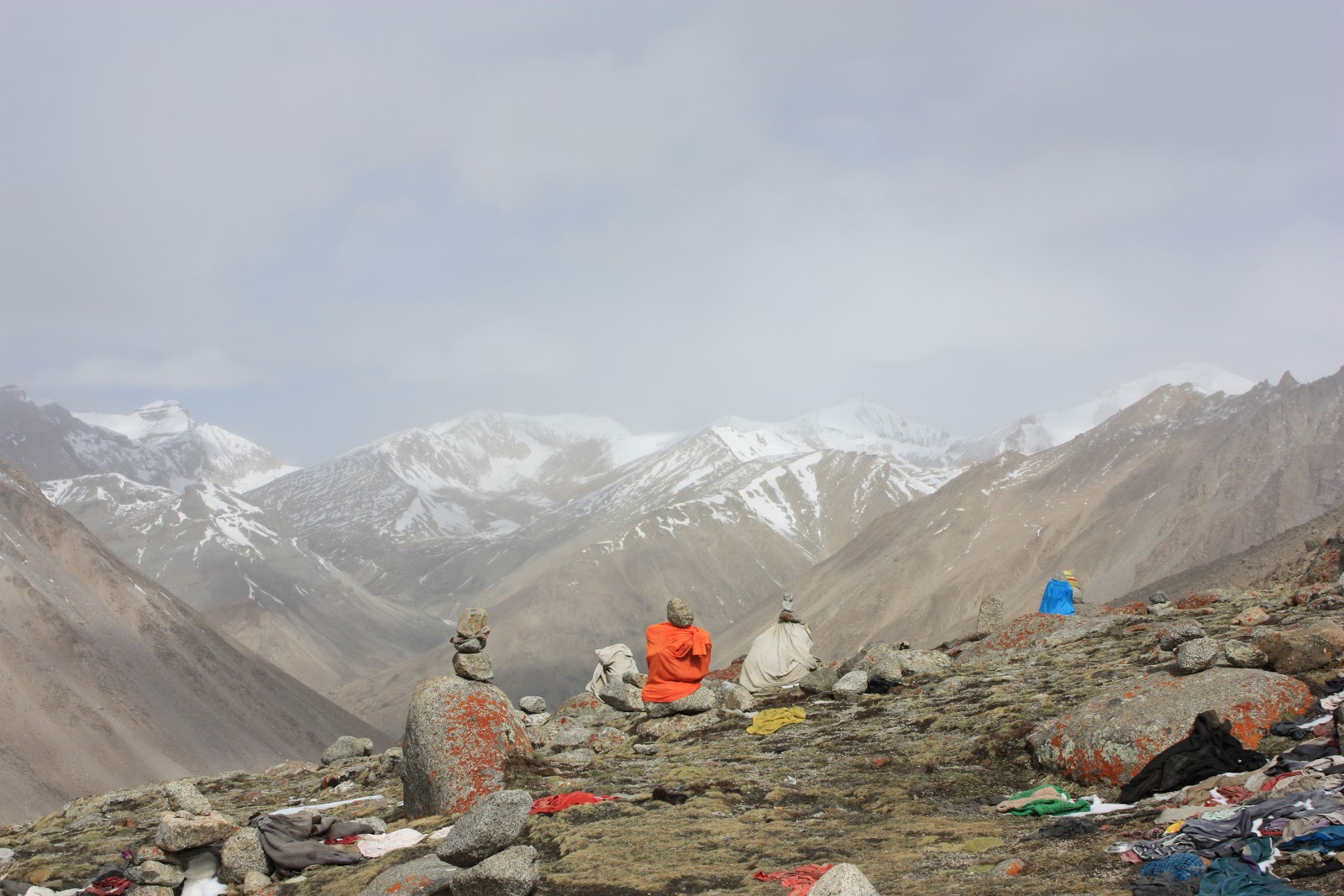
There was a stream of Tibet pilgrims heading up the pass, some looked incredibly old, others completing full prostrations all the way to the top, it was a pretty amazing sight. I just stuck to a slow and steady pace and slowly but surely I made it to the top. One of the biggest challenges once you reach the top is negotiating your way through a wall of prayer flags. What my sound easy enough when your out of breath, there's no oxygen in the air to begin with and your partially delirious, getting through this with your pack on and not falling over isn't easy.
We spent about half an hour resting at the top before the weather took a turn for the worst and the wind and snow flared up. As we started our decent in the mini blizzard, then trudged through ankle to knee deep snow I felt a sense of euphoria. I didn’t feel cold or tired but high and happy and this lasted for probably the next two hours, was it the mountain or just a lack of oxygen.....
We stopped for a brief rest at a large rock once we were out of the snow not knowing that it held Milarepa's foot prints until a group of Tibetans stopped to bless their Mala's on it. We then continued down to the bottom of the valley stopping at a tea tent to warm up and have some food.

The weather seemed to be closing in from all sides and it was cold and windy. We had a river crossing coming up and while I was looking for a way across I slipped and fell in. The other two that were with me just stared and laughed, a Tibetan ran over and pulled me out as with the weight of my pack I was stuck with my arse in the water and my feet up on a rock. It was actually pretty funny. This point along the track (and my life) that I fell in would correspond to me being about 15ish, not exactly sure what significant event happened in my life then, I'll have to think about it some more. After I took off my wet undies we continued on and the same Tibetans later led us across the river and actually carried one of us across on his back.
It was a tiring day and when we finally made it Zutulpuk Gompa we all had a feed and went straight to bed.
Day 11 Zutulpuk Gompa (4,835m) to Darchen
 We woke up to fairly nice day and everything being covered in a layer of beautiful white snow. We explored the Gompa which was built over a Milarepa cave and saw some more of his hand prints in the rock. We then set off on the final leg of the Kora which would be flat and easy.
We never got to see the east face of the mountain while on the Kora as it was always covered by clouds. It took an hour or two to get to the final prostration point and then another hour or so to get back into Darchen. The final stretch opens up to the plateau with Lake Manasarovara and the Himalayas to the south. It was flat open walk on the Southside of the mountain back into town where we were all looking forward to a good meal.
Day 12 Chiu Gompa to Langbona Gompa

After breakfast we left Darchen for the time being and drove about an hour to Chiu Gompa at the shores of Lake Manasarovara where we would begin our second Kora this time around the holy lake. Tso Mapam as it is known in Tibetan is also very sacred to both Hindus and Buddhist’s.
Hindu's believe that it is the mental creation of the God Brahma and that it represents the omnipotence of his mind. It is said that anyone who bathes in its waters will go to the paradise of Brahma and those who drink the waters will go to the heaven of Shiva and will be released from the sins of 100 births.
It is a holy site to Buddhist’s because it has been empowered by Shakyamuni Buddha (the historical Buddha). It is said that he travelled here by magical means along with 500 disciples and the serpent king of the lake caused a lotus of 501 flowers to blossom. Shakyamuni sat in the centre while his disciples sat on the surrounding flowers while he taught the dharma. Bathing and drinking the water from the lake is believed to have purifying qualities from a Buddhist’s perspective also. The lake can further be envisioned as an eight petal lotus or as a mandala square with four doors in the cardinal directions.
In addition to the religious significance the lake is one of the world’s highest bodies of fresh water resting at 4,580m above sea level and in 1948 some of Mahatma Gandhi's ashes were carried here from India and spread across its waters.

Chiu Gompa is a beautiful Gompa set on a free standing hill that looks down onto the lake and has a view of Mount Kailash to the north. Within the Gompa is a cave that Padmasambhava meditated in. It was here that we began the 104km Kora and where we would complete it four days later. Only four of us set off on the lake Kora as the two English guys remained behind to complete some person practices.
 We set off after lunch across the swampy plains that then led us to a pebbly shore walled by rocky cliffs. For the next two hours until we headed inland, the cliff face was dotted with meditation caves, some small and simple, others looked quite elaborate (at least for a meditation cave). It was an easy four hour walk to Langbona Gompa where we were greeted by a very old looking monk who was the keeper. The place was very simple but the old monk was very hospitable. After we all re-arranged the room we would sleep in to ensure that the beds were no longer under the holes in the roof, we had some dinner, explored the Gompa and surrounding area then called it a night.
Day 13 Langbona Gompa to Seralung Gompa

We set off about 9ish heading towards the lake at about a 45 degree angle; Langbona Gompa is at least 1km inland. Our guide had been insisting that we take the long way around and cut through a neighbouring town to avoid a river crossing, apparently someone died last year... (I don’t think he could swim) But we had clear instructions from Roger, our tour organiser who has done the Kora numerous times so there was no way that the 80’s crew was going to take the extended route – Not because it was longer, but because we wanted to stick to the true Kora path. Our other team member did however opt to take the extended trail as she had done the Kora a few years back and hit large areas of bog and swamp while looking for a safe way to cross the river. Our guide points would be a couple of small lakes that should be visible on our left and the snaking of the river to indicate our crossing point but this would be a couple of hours off yet.
We crossed some fields and made it to the marshy shores in about 45mins. It had been an overcast and cool morning but it was now starting to clear up. The night before we had noticed a large white object on the shore of the lake and we now approaching it, it looked like a huge pile of snow and ice which was quite unusual for this time of the year given its size, it was about as large as a jeep. Upon close inspection it turned out to be a melted, or melting, igloo! There were actually two of them. Not sure who built them, they were defiantly unexpected.

We could see the mouth of the river in the distance so we knew that we would need to head inland to find a suitable crossing. A herdsman with his grazing Yaks were on the far side of some marsh so we followed Norbu across and after a chat he led us to a point to cross. We stripped down to our undies, Norbu just rolled up his jeans, and I went first. It was pretty cold but the sun was out so it wasn’t too bad. The water made it up to mid-thigh on me, unfortunately for Norbu rolling up his jeans wasn’t enough and they got quite wet. After a short dry out on the shore we were on our way. We followed the river up to the Indian camp where we actually had another river crossing; this one was only about ankle deep though.
As with Mount Kailash the majority of the Indian’s just travel by jeep to a couple of scared spots and do Puja. There would have been a couple of hundred people here were they collect the holy water, bathe and do many Puja’s. This was an ideal spot for this as there was a huge grass plain onto the lake with good views of Kailash weather permitting.
After offering some prayer flags we were on our way, it was an easy hour or two walk from here to Seralung Gompa.

When we arrived at Seralung, and while it was still a bit warm we headed down to the lake shore where me and the other guy went for a quick dip in the lakes holy waters. The water was fresh and the cold wind didn’t help either.
Seralung Gompa is actually the best place to start the Kora as it is the eastern gate to the mandala, but for reasons of practicality we begun at Chiu Gompa.
Day 14 Seralung Gompa to Trugo Gompa
 What started out as a cold and cloudy mourning turned out to be the nicest day we had in the whole area. The sky was clear, it was warm and we had an amazing view for the entire day over the lake and onto a clear peak of Mount Kailash. It was a long but easy walk to Trugo Gompa. We stopped for lunch on a pebble beach and with the clear sky, the warm sun and the still water you would never have guessed we were at 4,500m. I took the opportunity for another purifying dip in the holy waters and then dried off on the shore in the sun.
I think we got into Trugo Gompa mid-afternoon. We spoke to the monks who opened the shop for us and bought some junk food which was a welcome break from Tsampa, noodles and oats! The view from here was also stunning; we had a relaxing afternoon and another early night.
Day 15 Trugo Gompa to Chiu Gompa

We were all pretty excited and although we had enjoyed the Kora of both the lake and the mountain we were pretty exhausted and looking forward to finishing our walking today. Again the day started off a little overcast and we even got a sprinkle of rain, but as we came around the south-west edge of the lake the sun came out and it turned into a beautiful day.
It was a good couple of hours along the west shore to Gossul Gompa where we had lunch. This place looked amazing; it was set in the cliff face and towered over the lake shore where the water was crystal clear and progressed through a number of shades of blue as it got deeper. Here at the Gompa I think that two monks were doing a Nyung Na practice which is usually done in the lead up to Saka Dawa; it often lasts for between two and sixteen days and among other things involves fasting and hundreds of full prostrations every day.
 We were now of the final stretch of the Kora and although we couldn’t yet see Chiu Gompa hiding behind a couple of points, I felt like I could smell it. We went pretty hard and got into the village about 3pm, I think. I then filled up a couple of bottles with some holy water to take home, picked up some incense from Chiu Gompa that may be mistaken for weed at Australian customs and we then headed back to Darchen.
Day 16-18 Saka Dawa – Darchen to Kathmandu

 Saka Dawa, the celebration of Buddha’s birth, enlightenment and parinirvana was today, the 15th day of the 4th month of the Tibetan lunar calendar of the Rabbit year 2138 (15/06/2011). After packing everything up we piled into the jeeps along with some older Tibetan’s in the back and we drove around to Darpoche where the giant prayer flag pole would be re-raised as it is every year on Saka Dawa. The final position of the pole (whether or not it is straight) will determine the fortune (not sure if that is the correct word) for the year.
  It was quite a different sight to what we saw here eight days ago when we passed by on our Kora. There were probably a couple of thousand Tibetans, numerous foreigners and too many Chinese military personal but the atmosphere was positive. Tibetans had small fires going everywhere boiling tea, hundreds of people continuously did Kora around the flag pole which had yet to be raised and everyone was trying to get their prayer flags and khata’s on to the long streams that would be attached to the pole when it is raised.
 We split up into smaller groups and went our separate ways, following the locals in Kora and just soaking up the atmosphere. It had been a cloudy morning but when it came time for the pole to be raised the clouds cleared and Kailash towered above. There was one main guy in charge dressed in an elaborate outfit, shouting commands to the many Tibetans at the end of ropes and the trucks that would raise the pole into place.

Just before it was raised into place the most important part of the ceremony had to take place… The Chinese military officials come in, parade around, make a speech on camera promoting the minorities within the motherland no doubt and then march out. All of the foreigners couldn’t believe what was happening but the Tibetans didn’t even bat an eyelid, after 60 years of occupation I suppose they just except it – a true practice of patience.
The pole was then raised everyone cheered and chanted as the pole went up and it looked perfectly straight to me, it should be a good year ahead. It was then time for more Kora around the pole and the Tibetans celebrated by chanting and throwing handfuls of Tsampa (roasted barely flower) in the air.
 |
| Trongba |
The Saka Dawa celebration was a great way to end our time at Kailash. After some lunch in Darchen we hit the road and continued onto Trongba for the night. The following day we made it to Nyalam by late afternoon where we stayed in our favourite guest house across the road from the all night karaoke club. And on the 18th day we drove down to Zhangmu where we said good-bye to our English comrades, drivers and Norbu, who would all continue on to Lhasa and we crossed the border and despite two landslides we made it back to Kathmandu by about 3pm giving me 3 hours to get to the airport for my flight to London.
It was an amazing experience and one I’ll never forget. I couldn’t have asked for a better group of people to travel with or a better tour operator to travel with either. Given all the restriction in travelling to and within Tibet it is only possible to go with an organised group. I researched for over six months looking for the right operator to go with but it wasn’t until I reached Nepal and while I was at Kopan that I found Roger’s company. Roger has done the Kora over 80 times and has been travelling and running tours to Tibet for over 15 years – If you want to go to Tibet, especially if you want to go to Kailash, he’s your guy. www.snowjewel.com